Showing posts with label Va'a Motu. Show all posts

Friday, 9 August 2024

Va'a Motu's first sail on Cascumpec Bay, Northport


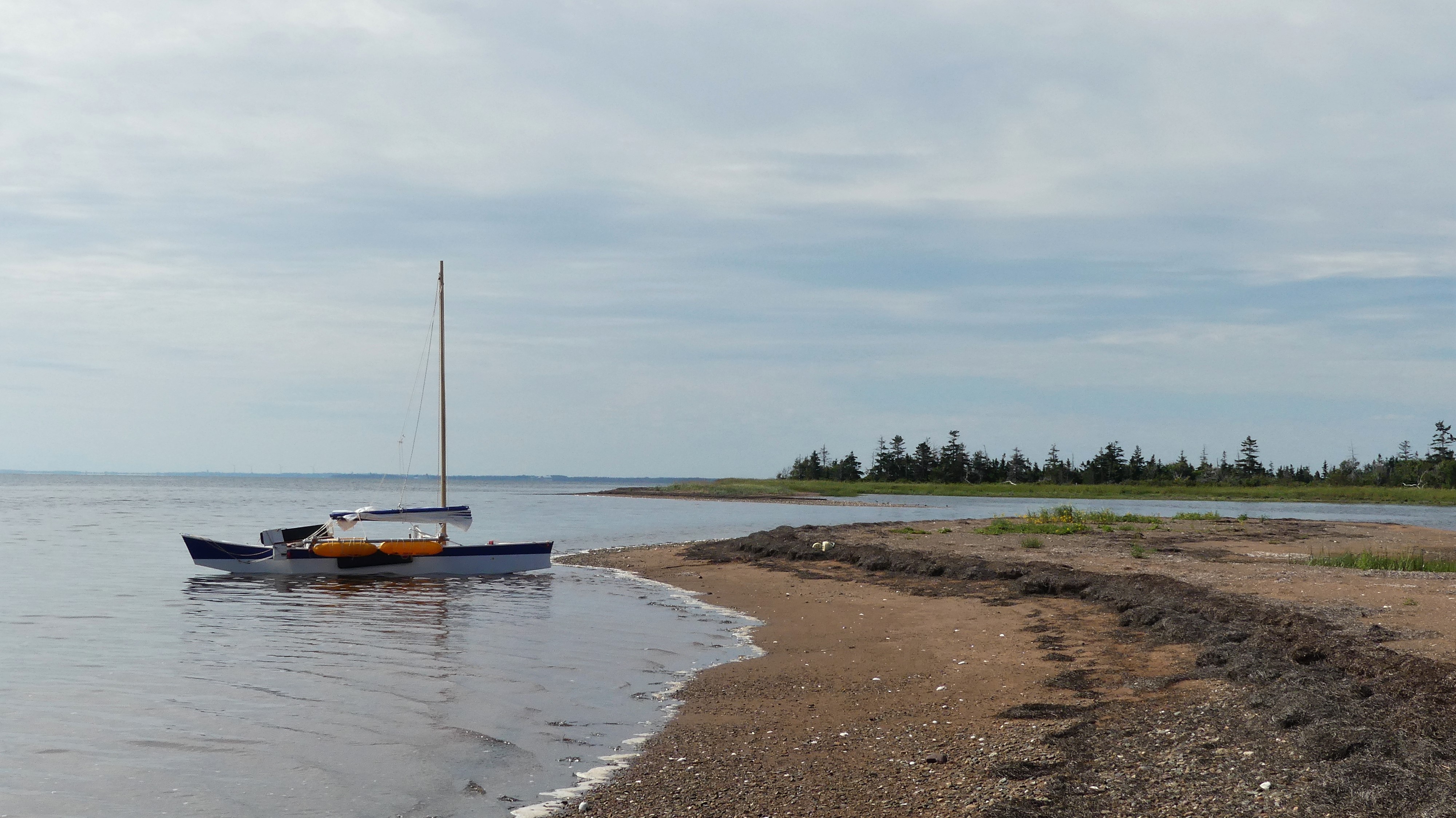
Cascumpec Bay (Keskamkek, Mi'kmaq) is a smaller bay than Malpeque Bay. However, it's still large enough for a day of sailing and some exploring. There are three access locations to Cascumpec Bay for sailing and paddling. Black Banks Road is good to access the bay from the SE. Due to the shallow waters at Black Banks, the location is most practical for small light boats (i.e. not the Va'a Motu). For the Va'a Motu, the two best access would be Gordon's Wharf and Northport Point. Gordon's Wharf is an oyster-working launch location that can get busy. Also, depending on the wind, you may have to use the outboard motor to get in and out of the launch shore. The best launch location for the Va'a Motu is the significant sand point at Northport. And, on August 9th, that's where I went to launch the Va'a Motu. The sand at Northport seemed deeper and less firm than in previous years, and I had to drive carefully to avoid getting stuck. 

Sailing track, Va'a Motu (16 km)


After launching, I sailed SE following the sandhills but keeping the KW waypoints to port. The KW (Keep West) waypoints mark the edge of the shallow sandhill waters. The destination was SHA15 – the best sandhill shore access between the two large sandflats of Cascumpec Bay. This area is an NCC property, so I did a monitoring walk. ATV tracks were visible on the gulf side. These tracks are probably from the lighthouse cottage near the Northport gulf channel.

Va'a Motu, Northport point


Largest erratic, Cascumpec Bay (SW point)


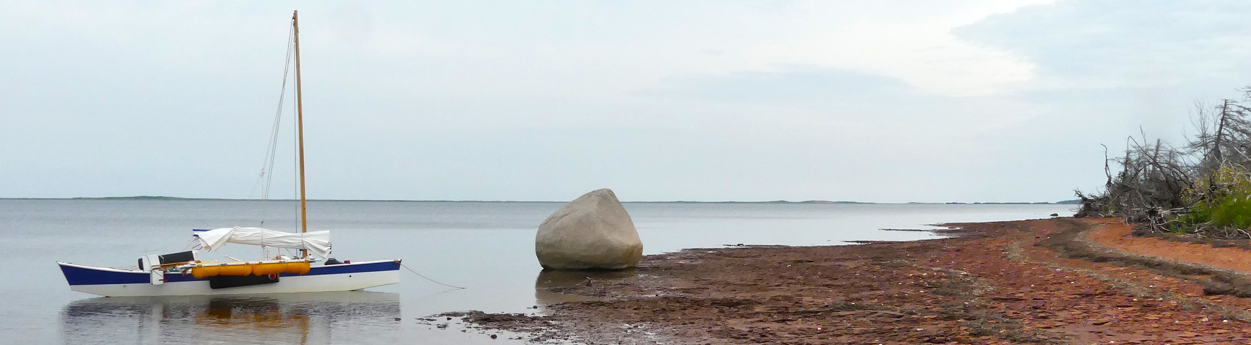
After my walk and lunch, I sailed westwards across Cascumpec Bay (3 km or so) to Erratic Point. I went ashore for a short walk and to take photos. Then, I made the sail passage (4 km or so) back to the Northport launch location. This was a good first Va'a Motu sail on Cascumpec Bay. Next year, I would like to spend a longer day on the bay to get to the south end towards Black Banks. I would also want to explore launching at Gordon's Wharf to avoid the deep/loose sand issue at Northport. It also requires less driving (saves 24 km). Either way, the Alberton tides should be 0.5m or higher to make sailing enjoyable on Cascumpec Bay.


American Germander (Imperiled in PEI)


Viceroy butterfly


Saturday, 3 August 2024

Sailing the Abrams Village inside channel

Va'a Motu at the sandspit

From Egmont Bay's Cimetiere Road to Abrams Village's fish processing plant, there's a 4.5km navigable channel inside the sandbars. Its average width depends on the tide level but is around 0.5 km. Since this channel is only a few minutes' drive from the cottage, I usually head there when I need a short sail (e.g. to test something or to give somebody a sailing experience). The launch at Cimetiere Rd is pretty good, but some shore areas have thick, sticky mud. The water level to launch and sail in the channel is 0.8m or higher (Cap Egmont). The usual destination is the sand spit on the other side of the Haldimand River (i.e. near the fish plant).

Sailing track, 16 km


On August 3rd, I took the Va'a Motu to the Abrams Village channel mainly for a fun sail. I had expected a west wind, but unfortunately, it was more of a stiff southerly breeze. It took me 15 tacks to reach the sand spit. That was OK, and I can always use more tacking practice. The Va'a Motu tacks pretty well as long as you have the leeboard and rudder well down. If you get in shallow waters (< 1m), you may have to gybe or get the paddle out to bring you about.

Va'a Motu outrigger sailing canoe - some assemble required


After a break on the sand spit, I started my downwind return trip at a good clip. I was soon crossing the lobster boat channel and missed seeing one of the channel markers until it was too late to avoid it! It hit both port side iakos, and luckily, the metal marker buoy was low enough to go under. Phew!

The alternate launch shore for the Abrams Village channel is McGee Road (la cote a Matt). It's a long dirt road that's not always in great shape. But, having a second option is good since the shore access at Cimetiere Road is sometimes not ideal.  

I have sailed out into Egmont Bay (Northumberland Strait) in the past for mackerel fishing but have not done that with the Va'a Motu yet. It's on my list, but the weather needs to be just right.


Friday, 2 September 2022

Malpeque Bay by Va'a Motu


The Va’a Motu outrigger sailing canoe was launched in the summer of 2021 but it was mainly short test sails. For the summer of 2022, I had a new mast and sail ready to go and did several sails on Malpeque Bay. One sail was to Courtin Island in the middle of Malpeque Bay, a couple were south towards the Grand River, and at least three were north towards the sandhills. On a beautiful day with 10 to 30 km/hr winds (preferably westerly), the Va’a Motu was perfect for heading towards the sandhills from the Willie Birch Road launch beach on the west shore of Malpeque Bay.

Va'a Motu Malpeque Bay sails (summer 2022)

The waters around Bird Island are fairly shallow except for the south shore. So, if the winds are not too strong from the west or SW, the south shore is a good option for a shore stop. Otherwise the east (lagoon) sand spits may be a better choice – assuming reasonable high tides. The south and north sides of Bird Island are the best shore walks. Beware of poison ivy! 


Dowitcher, sandhills


Bald Eagle, Hog Island


With the right winds and if the tides are high enough, it’s fun to sail over to the sandhills north of Bird Island and Lennox Island. Behind Bird Island, the sandhills are quite wide and it would be hard to cross over to the gulf side. That’s OK. The sandhill’s inner shoreline has lots of nature and is great to explore. If you sail further west (behind Lennox Island) where the sandhills are narrower, then you have the option of crossing over to the gulf side for a walk. Another option to visit the sandhills is east of Hog Island. Here too, the sandhills are quite wide unless you go to the bitter end (i.e. Fish Island, Malpeque channel).


Hog Island is well-isolated in Malpeque Bay and is always a special place to visit. Hog Island (also known as George Island) is part of the Mi’kmaq nation reserve and permission is required to go ashore/inland. Over the last few years, I always see Bald Eagles on the southern part of Hog Island (nesting, TBD). There’s also a cormorant colony at the south tip of the island. Both the west and east sides are great for shore walks. The north side of Hog Island with the sandhills forms a unique basin that is fun to explore. The basin is over 1 km long but only 200-300m wide, so it’s not so easy to sail under certain wind conditions (better in a kayak). The eastern end of Hog’s north shore is a very special geological place for PEI. It’s the only location where igneous rock (vein of dolerite) can be found on PEI. 


I got the most iNaturalist postings from the August 16 trip. Sightings are HERE.

I’m already looking forward to next summer for more Va’a Motu outings on Malpeque Bay. Now that I have more confidence in the boat, I’ll have to take some sails across to the eastern and southern parts of the bay.