Tuesday, 23 August 2022

The Pierre-Jacques Rivers, Egmont Bay


This summer, I finally went to explore the two Pierre-Jacques (PJ) Rivers of Egmont Bay. These two rivers flow into the NW part of Egmont Bay, about halfway between Brae Harbour and West Point. The mouths/estuaries of the two rivers are only 2 km apart but they are not related (i.e. they have separate watersheds). The Little PJ has a large estuary as it meets Egmont Bay (Wolfe Inlet and a 2 km sand spit). The Big PJ also has sand barrier banks and a rich salt-water marsh estuary as it comes into Egmont Bay. These unique estuaries should be good habitats for all kinds of sea creatures and birds.  


Pierre-Jacques Rivers (WD12, 10 km)

I didn’t necessarily pick the best day for a kayak trip. The weather was unsettled, and through the paddle, I got some strong winds and rain at times. I launched the WD12 kayak at the end of MacDonald Road (R176). MacDonald Road is a great spot to launch for exploring both rivers and the Glenwood sand spit. I paddled across Wolfe Inlet to the west exit going towards the mouth of the Big PJ River. There were many seagulls and shorebirds gathered on the sand banks at the mouth of the river. I got through the narrow channel into the Big PJ River and found that the water inside was very shallow. I circled a bit taking photos of the many birds in the water and came back out.


WD12 and iffy weather


Greater Yellowlegs

Before heading back to Wolfe Inlet, I went to explore the point to the west of the Big PJ River. Inland, behind that point is a good size salt-water marsh and a flock of Mallard ducks was present. After a shore walk, I headed back towards Wolfe Inlet in the wind and rain. I made a stop at the west end of the sand spit for a break and to decide if I should continue. The weather soon improved, so I decided to finish the planned route and try paddling up the Little PJ River. To my surprise, the Little PJ River isn’t as shallow and I was able to paddle over 1 km upriver. There’s no development on the river for 1.5 km, so it feels pretty isolated. For the short time on the river, I observed and photographed an Osprey, GB Heron, Cedar Waxwing, and a Kingfisher. See my iNaturalist page for the day – HERE.


Osprey


Great Blue Heron

Since the weather was holding, I paddled to the east end of the sand spit for a beach walk and a bite to eat. After lunch, I paddled straight back to MacDonald Road in worsening weather. It was just in time – once ashore and the kayak loaded, the wind got pretty strong and scary!


Kingfisher (typical pose; one of my favourites)

----------------------------------------------------------------------------------------------------------

Pics from my June 21, 2023 paddle trip up the Big Pierre-Jacques River - all the way to Glenwood Pond. I had lunch at the pond before paddling back to the launch at MacDonald Road. Great day!
Here's a link to the iNaturalist postings for the day. CLICK HERE.


Track, 21Jun2023


Pics from my Sep 1, 2023 paddle trip up the Little Pierre-Jacques River - all the way to Hebron Road and back. Another great day on the PJ rivers, Wolfe Inlet, and the Glenwood sand spit!
Here's a link to the iNaturalist postings for the day. CLICK HERE.


Track, 01Sep2023


Friday, 12 August 2022

Crown Point - Alexandra, PEI


On the morning of August 22nd, I was taking Anne to the Charlottetown airport so I took the opportunity for a paddle at INT’s Crown Point property near Alexandra. The first thing after the airport (7am) was to find a Tim Horton for breakfast and coffee. Around 8am, I was at the end of Wharf Road, Alexandra – the recommended launch point for Crown Point. The tide was high, so launching and paddling away from shore was no problem.  Note: This launch point is high and dry as soon as the tide goes out, so make sure to bring the kayak cart.

Crown Point, INT (Merganser kayak, 10km)

The weather was pretty good but I was worried that later in the day the wind might come up, so I planned to go and explore the more exposed south shore first. I made a straight paddle to the east corner of the south shore (about 3 km) and went ashore for a walk. It’s a beautiful clean sandy beach for a walk with sandstone banks/cliffs and a thick conifer forest inland. At the top of one of those conifer trees, a Bald Eagle was keeping an eye on me. It wasn’t too disturbed and stayed in his perched for the entirety of my beach walk. On the return paddle, I made another stop at the SW point and did another walk on the south shore. Here the sandstone cliffs are more pronounced and due to erosion, there are nice formations and lots of pieces scattered on the shoreline. I did look for signs of fossils but didn’t make any discoveries!


South shore (SW point)

For continuing my return paddle, I had to go further from shore to find deeper paddling waters. The bonus is that a group of Harbour Seals came to check me out for a few minutes. Once they got bored, I decided that the tide might still be high enough to explore the bay that borders the north boundary of the Crown Point property. But, it wasn’t. I got in about halfway in a foot or less of water and then decided to turn around before getting stuck in the mud.


Bald Eagle


Harbour Seal

Other iNaturalist postings for the day are found HERE.

Overall, this was a great paddle in a very natural area and I will try to make other paddling trips here over the next few years but with a bit more planning around the tide cycle.


West shore


North shore


Semipalmated Plover


Spotted Sandpiper


Wednesday, 3 August 2022

Kildare River Estuary


PEI’s north shore sandhill barrier islands have a total length of 40 km. I can finally say that I have paddled/sailed the full extent of the sandhills from Malpeque Bay (Fish Island) to the Kildare River estuary. On August 3
rd, I was going to an INT evening event in Alberton, so I came earlier in the day with my kayak and did a paddle in the Kildare River estuary from the bridge on R12. What a great place to explore!


Kildare River estuary (7.5 km paddle)

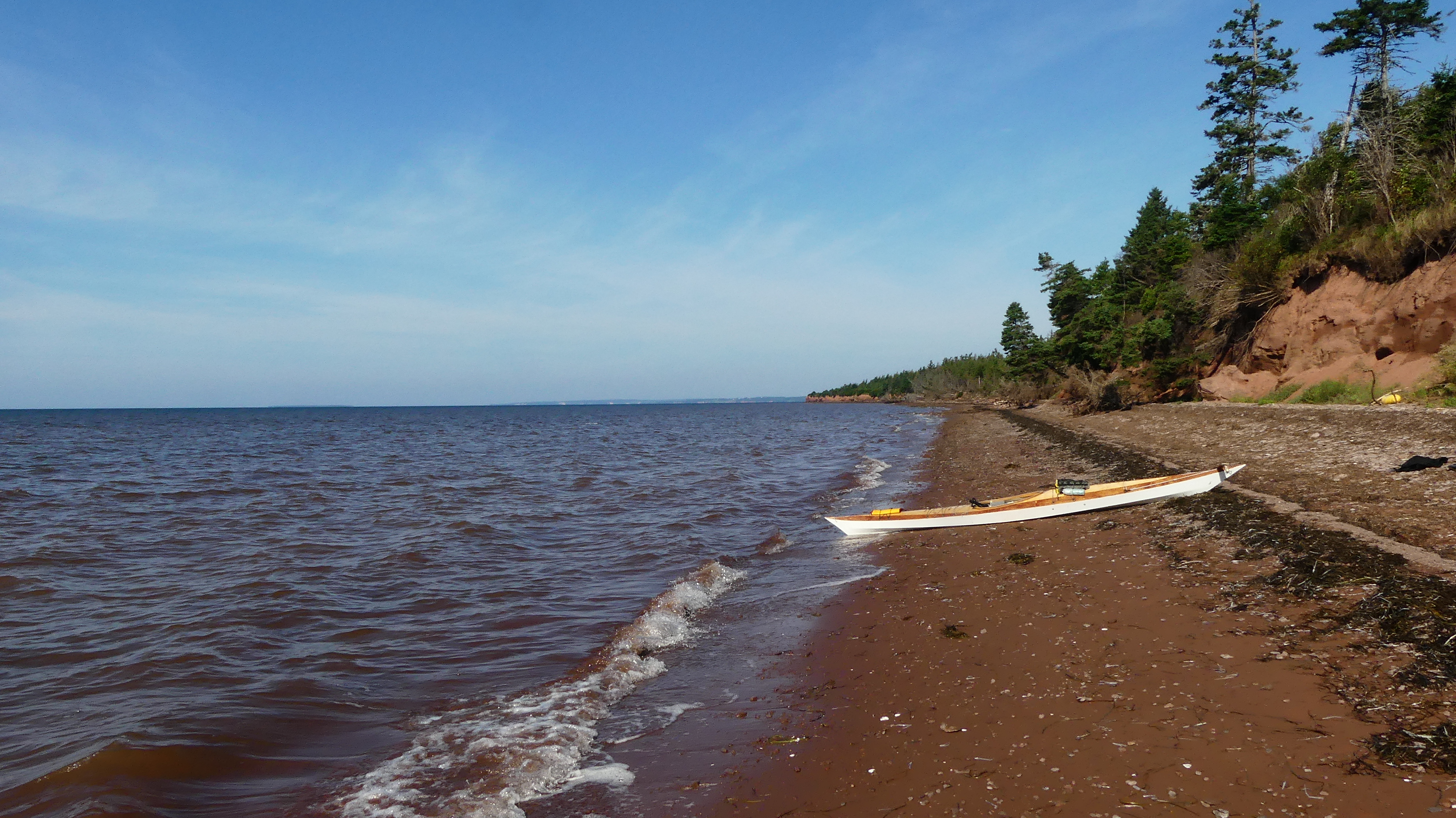
After launching from the end of the R12 bridge, I headed east towards the sandhills. As I approached the sandhills, I noticed that the current was fairly strong – the tide was going out. At the sandhills, I made a left turn (north) and went as far as I could in the shallow waters of the estuary. I went ashore to explore and check out the beach on the gulf side. The sandhill is narrow at this location (150m) and easily walked. I noticed a few plant species to photograph for iNaturalist including a few nice shrubs of Smooth Gooseberries. Luckily, I had a container and collected a few cups for some delicious gooseberry jam. See my iNaturalist page for August 3, 2022 - HERE.


Smooth Gooseberry


Starry False Solomon's-Seal

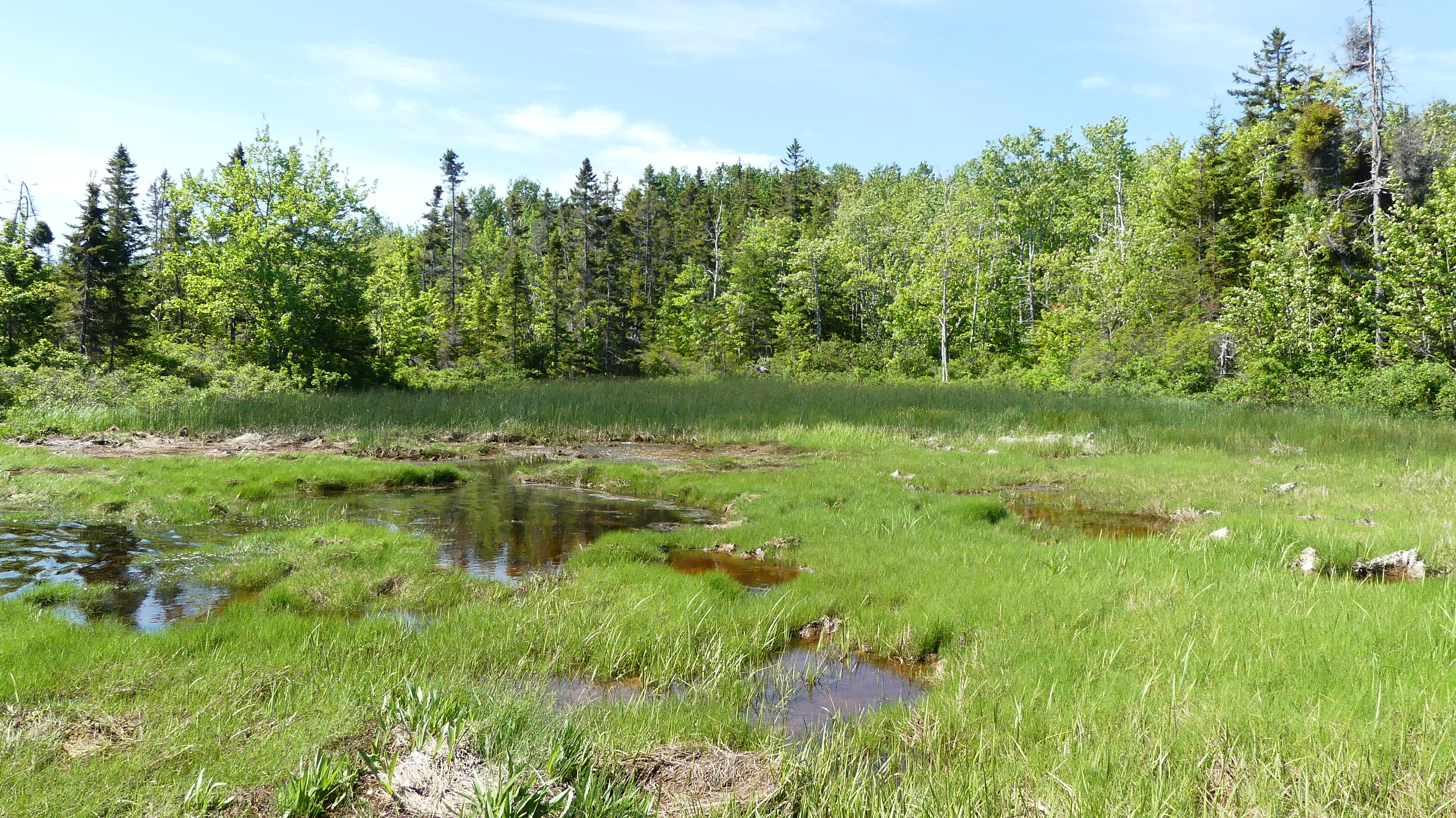
After my shore visit, I paddled south along the sandhill for about 1 km. I would have liked to go further, but I was worried about getting back with the lowering tide conditions. Before starting to paddle back, I went ashore for another walk and a snack. At this spot, I noticed a few building structures on the sandhills (cottage, TBD). There’s no power or services here, and these buildings would be very exposed to storms (e.g. Dorian 2019, Fiona 2022). On my return to the R12 bridge, I decided to take the same route back. This route seems to be the marked channel used by boat traffic.  I would have liked to explore the SE side of the estuary but it would have been a paddling issue with the low tide.


Great Blue Heron


Bonaparte's Gull

On the return paddle, it was nice to see so many seagulls, herons, and shorebirds. The Kildare River estuary is definitely an area that needs more paddling and exploring in the future. Next year, time the outing better with higher tides, and don’t forget containers for the gooseberries!

The Kildare River estuary

Also, it would be interesting to paddle up the Kildare River towards Montrose. The river’s name seems to change to Montrose at some point. As well, there’s a large tributary to the east before Montrose (named the Huntley River on some maps). 


--------------------------------------------------------------------------------

Sep 10, 2023 paddle (17ft Merganser kayak).

For the iNaturalist posting of the day - Click HERE.

Track, 10Sep2023 (16 km)


Wednesday, 15 June 2022

Haldimand River (aka La Riviere a Charles)


The Haldimand River is one of those small rivers in rural PEI that doesn’t get very much boat traffic if any at all.  The river’s main section (& mouth) lies on the border between the communities of Abrams Village and Maximeville but some of its many small tributaries and source are in Cap-Egmont and St-Timothee.

Haldimand River, 6.6 km paddle (WD12)

As shown in the map, the NCC has acquired a fair amount of land around the Haldimand River. They see it as a rare undeveloped salt-water wetland area in PEI. Lately, INT has also acquired properties in the area (St-Timothee and John Paul Road). A tributary of the Haldimand does flow across one of the JP Road INT's properties.


Over the years, I have always use the bridge on R11 as my kayak launch site. But next time, I should try launching on the river’s east channel from the Haldimand River Road.

I try to paddle the Haldimand once a year (WD12) but often didn’t get too far due to low tide or high winds. This year’s paddle was on a nice calm day and the tide was reasonably high. The conditions allowed me to paddle my 12ft Wood Duck kayak further up the river than at any other time. In the end, I was blocked by fallen trees across the narrow river/stream. Going further upriver would be a challenge, but would be worth a try in the spring at the peak of high tide. The Hiawatha canoe may be a better option for getting out and hopping over some obstacles.


As you go up the Haldimand River, it gets quieter and more pristine! The vegetation in June was very lush and I did make a few observations for iNaturalist. On my next trip, I need to reserve more time for nature observations and photography.


Northern Flicker


---------------------------------------------------------------------------------------------------------------------------

2023 paddles on the Haldimand River (Jun 22 and Sep 28).
Jun 22 iNaturalist postings.  Click HERE.
Sep 28 iNaturalist postings (lots of fungi).  Click HERE.


Jun 22 track (8 km)


Sep 28 track (8.2 km)


Wednesday, 6 October 2021

NCC properties on the Enmore River


I have paddled sections of the Enmore River in the past.  Most of these were canoe outings in the spring for Brook Trout. There are two bridges across the Enmore River – the main Enmore Road bridge and the smaller Mill Road bridge.  For fishing, I have usually launched at the Mill Road bridge for closer access to known fishing holes on the upper Enmore River.  


Today, I went on the river to check out a couple of NCC properties bordering the river and enjoy the autumn scenery. I launched at the Enmore Road bridge and started paddling upriver following the west shoreline.  The pseudo plan for the day was to paddle as far upriver as possible with the Wood Duck 12 kayak (WD12).  On this trip, with reasonably high tides, I could paddle about 3.5km upriver from the Enmore Road bridge.  I’d be surprised if the river is navigable much further at the best of times.  There’s a walking trail following the river, which would be an excellent way to explore the upper Enmore River & creeks further.


Enmore River


Great Blue Heron

I checked the first NCC property on the north side of the Enmore Road and the west side of the river (i.e. NW corner of the bridge). This is a new NCC property, and I didn’t see anything to report. The second NCC property is on the east shore, and I made a stop there on the way back for a look around. The east property has a large marsh area bordering the river. The marsh is separated from the river by a high embankment – likely built by early settlers to better cultivate marsh hay/grass.


Marsh at NCC property (east)


Embankment between marsh & river

On a beautiful calm day, paddling the Enmore River is very relaxing and enjoyable.  There are not too many rivers in PEI where you can paddle for a few hours and not encounter any development or people!


Colourful mushrooms


Poison Ivy can also be colourful in the fall


Beautiful day on the Enmore!


Wednesday, 29 September 2021

Foxley River - Canadian Bridge, PEI


In western PEI, another relatively undeveloped waterway to paddle and explore is the Foxley River. Last year, I explored the lower Foxley River from Gordon’s Wharf, so today (Sep 29), I headed to the Canadian Bridge (route 168) to check out the upper parts of the river. The Foxley River has quite a few tributaries and inlets. The plan was to paddle east and explore the river up to the Foxley River bridge (route 12 E) and a few small side tributaries. But due to the strong NW winds, I decided to head west from the Canadian Bridge. It’s always a good idea to try and have the wind on your back when you are tired and making your way back to the launch point. 

Foxley River (track from Canadian Bridge)

In a stiff breeze, I made it to the mouth (east side) of the MacDonald River. After exploring the shoreline at that river junction, I decided to paddle across the Foxley River and hopefully find some shelter from the NW wind. As I was crossing, I noticed a Bald Eagle in a tree on the north side of the river. I managed to get a few distant shots before it flew deeper into an inlet on the north shore. I paddled into the inlet, but it was nowhere to be seen!


Canadian Bridge launch


Bald Eagle

Earlier, I had spotted a sandy beach on the north shore, so I made a stop there for lunch and a walk. On that north shore, you can get a good view of the Foxley River/Bay (i.e. the aquaculture operation) by climbing the 10ft cliff. After lunch, it was time for more paddling exercise, so I paddled up the 1km Canadian Creek against the wind. The wind was annoying but not as much as the manure odour from a local farm. A flock of Canada Geese is all I found at the bitter end of the creek.


Wood Duck 12 (WD12)


Great Blue Heron

The Canadian Bridge is a great launch spot, and I will be back next year to explore the eastern end of the Foxley River (kayak) and go up the MacDonald River (kayak also).


Lunch shore (Foxley River, north)


Erratics (mouth of MacDonald R.)