Tuesday, 21 August 2018

Malpeque Bay, PEI - Sea Pearl camping trip


It was getting late in August, and since I had brought some camping gear from Ontario; it was time to go out for a short Sea Pearl camping trip.  In PEI, there are not very many great camping SP areas.   Malpeque Bay is the best one in western PEI. It's relatively isolated, somewhat protected, and big enough for a few days. It's protected from the Gulf's big waters, but, with the right winds, the Bay can get quite rough and choppy.


Malpeque Bay, PEI

On Aug 20th, I drove to the ramp at the Bideford station (near Ellerslie).  The ramp fee is $10/use. After launching the Sea Pearl, I went back home to drop off the trailer, and Anne drove me back to Bideford. From Bideford, I motored to the shore at Port Hill (about 5km). 

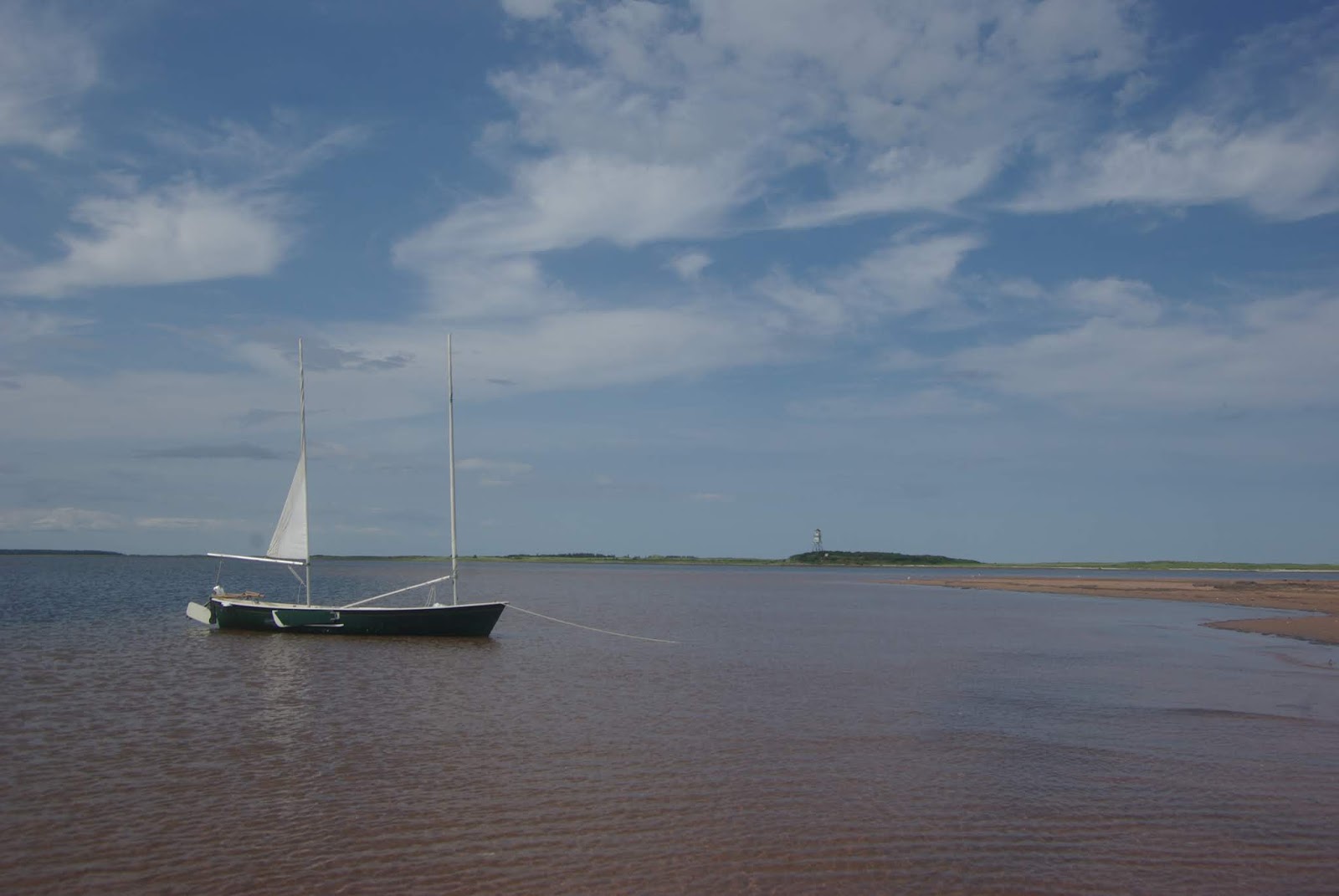
After setting sails, I headed out in Malpeque Bay towards Ram Island.  The winds were out of the south and not very strong (10-15 km/hr).  Before reaching Ram Island, the low tidal waters forced me to turn NE towards the Malpeque channel entrance. By mid-afternoon, I had reached the little bay near the old Malpeque lighthouse on Fish Island (about 12km from the Port Hill shore).  This would be my anchorage for the first night.  It's a lovely shallow bay, but there's no protection if the winds get strong from the south or west (which they tend to do in the summer)!

Weather permitting, Malpeque Harbour (Darnley Basin) may be a better place to spend the night next time -- or bring a tent and sleep ashore.

That was it for Day 1 sailing.  I spend the rest of the day exploring the area (e.g. old lighthouse), walking on the sandhill, photography, and dinner—a pretty good first day to my SP camping trip.  The night wasn't as good. The wind came up a bit (SSE 12km/hr) and interrupted my sleep.  The SP is pretty light, so it doesn't take much wave action to rock the boat.  That would be another good reason to sleep ashore in a tent.


SP21 resting in Fish Island bay
Old lighthouse, Fish Island


Day 2 (Aug 21st)
On Aug 21st, I awoke to a calm morning, and it stayed pretty calm until mid-afternoon.  After breakfast on the beach, I crossed over to Cabot Park to look around and got some boat maintenance done (e.g. deck clean up). After seeing some fishing boats in the Malpeque channel (I assume mackerel), I decided to try my luck. I had a hard time finding deep water and didn't want to go too far into the Gulf.  There were no bites, so it was time to set sail and make for Ram Island. I got to Ram Island with a very light breeze after an hour or so, and it was almost time for lunch (4.5km).  Before lunch, I had a good walk around the island and was surprised to see that the cormorant colony is mostly gone! I did see one bald eagle flying around.

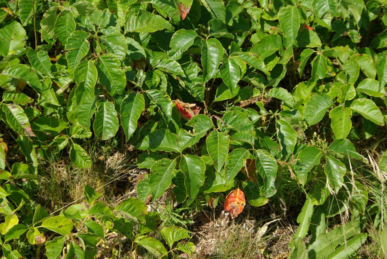
After lunch, the winds suddenly came up, so it was time to make for Hog Island's NE corner (Iron Rock). The 7 km sail to Iron Rock was great, with a good breeze coming out of the south (15 km/hr). I anchored the SP off the sandhill shore and walked across to the Gulf side.  I did see poison ivy in places, so you have to be very attentive to any low vegetation that is not seagrass!  After a nice walk on the beach, I returned to the SP and crossed over to Iron Rock point, planning to spend the night.  The winds got stronger from the SSE, and it was getting iffy if the point was the best anchoring spot for the night.  I did have a look further in the shallow back bay but failed to find a better anchorage. After dinner and a bit of exploring/photography, I went to bed aboard the SP.  It was another night of interrupted sleep from a rocking boat and wind noises (S 20km/hr).  Again, sleeping ashore in a tent would have been much better! I'm not sure that camping on Hog Island's shores is allowed without the permission of the Mi'kmaq people.


Cabot Provincial Park
Cabot Provincial Park (south of)

Iron Rock, Hog Island
The channel behind Hog Island


Day 3 (Aug 22nd)
Early on the morning of Aug 22nd, the wind was quite strong from the south (20km/hr) and was probably going to get stronger as the day heated up. So I decided to make for the more protected shores of Low Point for breakfast. To save time, I motored upwind until I was cleared of Hog Island, then set sails and had a fast beam reach to Low Point. There was 2-3 ft of chop on Malpeque Bay, and I had to head-up a few times to avoid broadsiding a few large waves. A bit too much excitement before my morning coffee!

At Low Point, I had a cold breakfast and then crossed over to the west side of Bird Island and went for a walk. I had a great walk on the west and south sides and briefly saw the second bald eagle of my trip. From Bird Island, I sailed/motored back to the ramp at Bideford station (7.5 km). I called Anne to come and pick me up, drove to the cottage to get the boat trailer, and then back to the Bideford station to get the Sea Pearl and gear. I was home by late afternoon – somewhat exhausted from my two nights of interrupted sleep. 


In good weather, Sea Pearl camping in Malpeque Bay is fun, assuming the winds are modest, tides are cooperating, and there’s low mosquito density. It’s tricky to get all four of these conditions in PEI’s short summer. I had pretty good conditions on this trip – except for the higher winds on the 3rd day. Lots of shallow waters in Malpeque Bay, so higher day tides would have been great, but the mosquitos were OK, so it’s hard to complain!

Overall, I learned a lot about sailing the upper Malpeque Bay in various southerly winds and changing tides. A great SP trip and my first time camping at Fish Island!


Monday, 13 August 2018

Courtin Island, Malpeque Bay, PEI


After finishing some renovations and maintenance on the Sea Pearl (SP), I was keen for a good sail. For SP sailing in PEI, Malpeque Bay is my usual destination (assuming the winds will be moderate). The forecast was for 8-10 knots SW.  Due to the PEI landscape, a SW wind usually means it blows down the Grand River or/and across from Summerside and quickly gets choppy above 10 knots.


Cliff at Low Point


View of Courtin Island from a few kms


I launched the SP at the Bideford oyster station ramp at the mouth of the Smelt Creek.  From the Bideford ramp, it's 5 km to get past Lennox Island and into Malpeque Bay. Today, the winds were not favourable to sail, so I motored to the beach at Coopers Lane (just past the old abandoned wharf to Lennox Island).  At the beach, I rigged the sails (2 turns on the main; 1 on the mizzen) and headed on a close reach towards Courtin Island. It's about 3 km from Coopers' beach to Low Point's red cliffs, then another 6 km across open waters to Courtin Island.   At 4 to 4.5 knots, it did not take much more than an hour to get to the NW corner of Courtin Island.


NW corner of Courtin Island


On the north side, in the lee of the wind, I continued to slowly sail to the east end of the island while checking out the shoreline and cliffs for any signs of Bald Eagles.  I went ashore at the east end for a walk and a snack. No eagles, but I observed some shorebirds and a huge patch of poison ivy.  Then, I decided to walk (in the water) back towards the NW corner of the island with the SP in tow and look for a good spot for a swim and lunch.  I spotted an osprey flying on the edge of the island, but he was camera shy.  After a km or so, I did find a great spot and had a refreshing swim and lunch. Then, it was time to return to Bideford.


Osprey on the move


Poison Ivy


The sail back across Malpeque Bay was a bit more spirited. The winds were a little stronger, and I was on a beam reach rolling with the waves. I had the sails trimmed again (2 turns on the main; 0 on the mizzen) and was usually doing 4.5 to 5.5 knots. I had too much weather helm from not reefing the mizzen. For more relaxed sailing, I should probably have reefed the sails more (main 3 turns; mizzen 1 or 2 turns).  I stopped again at the Coopers' beach to switch to Honda-san and then motored the 5 km to the Bideford station ramp. 

Beautiful day at Courtin Island and great sailing on the big bay!


My lunch spot


Lunch on rocky ledge


Lunch view


Friday, 28 April 2017

Fishing on the lower Enmore River, PEI


This spring (April 2017), I had to launch my canoe at the paved bridge in North Enmore to get on the river for some trout fishing. Many people fish at the bridge, but I decided to head upriver to a hole (FH4 ER) on a zig-zag bend in the river. It’s close to 2 km of paddling to get there, and it took me some time since I had to check out a few side channels – including one that still had some ice. 


Once I got to FH4 ER (Fishing Hole #4, Enmore River), the trout were there and biting. I quickly landed four small ones in the 8” to 10” range. One larger trout got away due to trying to land it in the canoe without a fishing net. And then, the trout stopped biting. 


After an hour, I headed back to the Enmore road bridge and tried my luck with the other fishermen there. I had no luck on the north side of the bridge where all the fishermen were trying, but when I moved to the south side of the bridge, I caught a nice 13” brook trout.  Not too bad for a morning of trout fishing within a 20-minute drive from the cottage!


Fishing Summary:
- Three hours of paddling and casting
- Used small spinner with worms
- Result = 5 trout (1 medium + 4 small ones)
- Enough for 2 dinners!


Thursday, 21 July 2016

Percival Bay, PEI - a trip to the NCC's Nature Reserves


After waiting for a few days, we finally got a day with winds under 10 knots. After double-checking my MYS15 outing checklist, I headed out (9:30 am) to McKie's shore in North Enmore. After launching, I started rowing north towards the Inverness Reserve in a very light tailwind. But soon, the wind was up, and I was going downwind at a good clip, even with a reef in the sail. I went by one oyster fisher, and I'm not sure what he thought of a sailboat this deep in the bay. In less than 20 minutes, I was onshore at the Inverness Reserve, fighting the horse flies. I did a quick walkabout and took a few photos. Things look a lot greener in the wetland than in May. 


I was soon back on the water and heading upwind towards the McKie Reserve (about 4km). After a few tacks, I made a landing on the western shore of Percival Bay -- right across from the McKie's shore launch site. The shore here is a nice sand/gravel beach with a small inland marshy area. There were pipers on the beach, and I spotted one blue heron in the marsh pond. After a snack, walk, and some photos, I headed back to the McKie launch site to retrieve my long outdoor pants for some extra horse fly protection. Horseflies only seem to attack your feet and lower legs!


With the standing lug sail still reefed, I managed to sail upwind to the W. McKie Reserve (2 km) in about half an hour. I could have gone a bit faster, but I wanted to test the new sail rig in the reefed configuration. Again, I went ashore for a short walk and some photos. The tide was high enough to venture into the Big Barachois marsh, but it was getting late for lunch, so I decided to sail straight back (downwind) to the launch site.

In a 6-8 knot wind, the MYS15 works well with the sail reefed. The MYS15 could probably handle up to 8 knots of wind without a reef. Although, less sail area is usually best for going downwind. 


Saturday, 28 May 2016

Leard's Pond, Coleman PEI - more trout fishing


On a lovely Tuesday morning (May 24th), Anne and I headed west to Leard's Pond on Route 140 between Coleman and Mount Royal (not far from O'Leary). In PEI's early days, many rivers and streams were dammed to harvest the power for mills, etc. Today, many of those dams have been preserved and upgraded as recreational fishing ponds (e.g. fish ladders). Leard's Pond is on the higher reaches of the Trout River watershed.


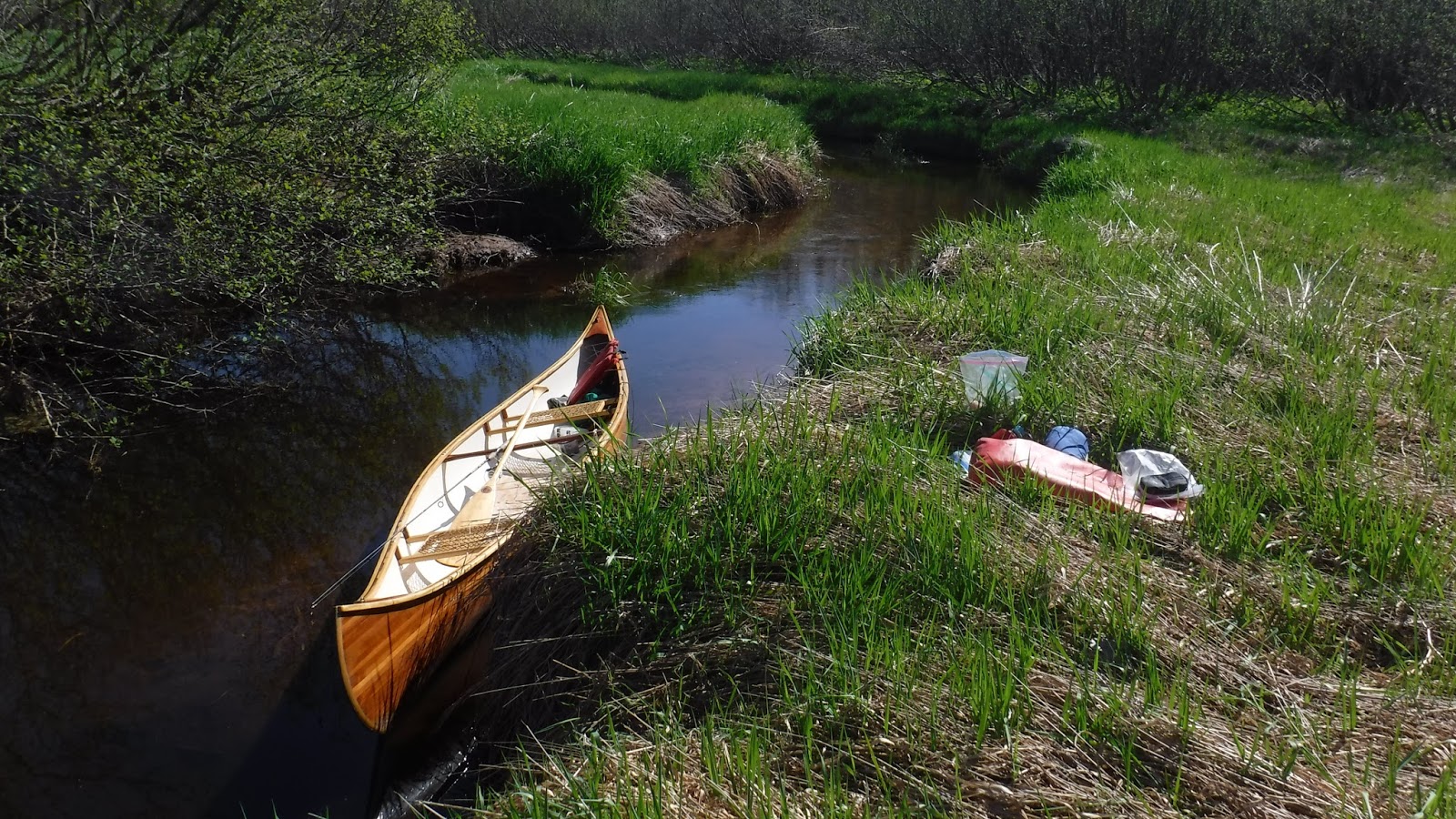
Anne dropped me off at Leard's Pond for a few hours while she headed out for some shopping in O'Leary and TH. Leard's Pond has a nice gazebo and a large parking lot. I launched the canoe in the Pond and headed upstream (Beaton's River on some maps).

The stream above Leard's Pond starts in an open wetland area, and after much zigzagging (1 km or so), it enters a wooded area. I was at the edge of the wooded area before landing my first trout. I caught two more trout in the same area, and it was time to head back to meet Anne.

Once you get away from the road, the stream (Beaton's River) is a great place for paddling and fishing – I'll definitely return to check for other fishing holes!


ds

Fishing Summary:
-         Two hours of paddling and casting
-         Used #1 silver Mepps spinner with worms
-         Result = 3 trout (8” to 10”); Dinner for two
-         46° 41.188'N;  64° 12.659'W  (FH2 BR)


--------------------------------------------------------------------------------------------------

21May2024 Update
I came to Leards Pond again to try my luck at some Brook Trout. No luck, this year.

My track for the day, Hiawatha canoe

I paddled up the creek as far as I could go. There were no signs of any fish (i.e. no bites).
I did see a few ducks, a Cormorant, birds, and some cedar trees. 
This might be my last outing here for a while -- at least for trout fishing...


Wednesday, 18 May 2016

Spring fishing on the upper Enmore River, PEI


Enmore River, PEI

Amazingly, most rivers in PEI have brook (speckled) trout. Brook trout does well in PEI due to the cold groundwater that feeds all the running rivers and creeks.

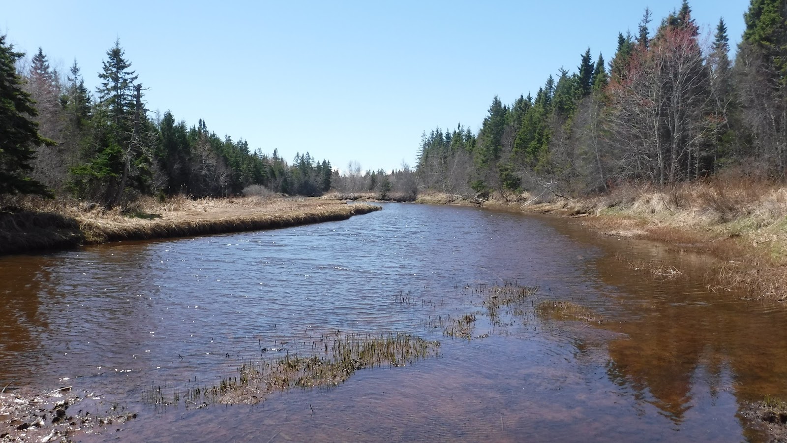
Today (May 18), I decided to try my luck on the upper Enmore River. The small bridge on un-paved Mill Road is a popular spot for local anglers. I decided to bring my small Hiawatha canoe and go further upriver. The river is still navigable for 1 km from the Mill Road bridge and probably more in early spring at high tides. 


Brook Trout

On the way upstream, I caught a couple of small trout (6"), so that was encouraging. The river bed is shallow and without any real deep holes. The water is deeper around bends, and the river bank has some undercut features in some areas. On the way back, I tried casting where I had caught the small trout earlier and was surprised to land a larger one (10"). More fishing in that area did not produce a second trout of that size, just another baby! I did not have my GPS, but I should be able to find that spot again.


Fishing Summary:
- Two hours of paddling and casting
- Used #1 silver Mepps spinner with worms
- Result = 1 trout (+ 4 babies)
- Enough for appetizers for two (yummy!)