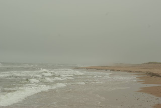
The Conway Narrows section between Cascumpec
Bay and Frederick Cove is the hardest to explore – especially by sailboat. The channels in this section are narrow, and
the water is relatively shallow throughout. So the best way to explore this
area of the Conway Narrows is by kayak at high tide. During the summer of 2020,
I made two kayak trips in this area from the end of Pete Con Road.
|
 | | Conway Narrows, the northwest half |
|
 | | GE map, July 29th, 15.2km track |
|
The
end of Pete Con Road is a good kayak and OSC launching point. It’s undeveloped,
and the sandy shore is firm enough to drive on the beach at the end of the road
(to the right). On the first outing, I headed SE to explore the Conway channel
islands and the sandhills. On July 29th, I was on the water fairly early in the
morning in very calm and misty/foggy conditions, which made for great paddling
and some beautiful scenery.
After
crossing the 0.5 km to the sandhill, I kept paddling SE along the shoreline
towards Frederick Cove. I made my way in the shallow water behind CONISA &
B and went to check out SHA30, but decided that it wasn’t a great place to
cross over to the gulf side. After
exploring CONISB, I went ashore at SHA35 and went for a sandhill beach walk.
Given the calm morning, I was surprised to see so much wave/surf action on the
gulf side. Then it was a short paddle around to SHA38 for another walk on the
sandhill and some lunch. After lunch, I explored as far as the huge Frederick
sandflat (1 sq. km) and then started my paddle home via the PEI shoreline. I
went by the end of Mickie Allan Road – where I should have stopped for a bitter
at the Moth Lane pub!
 |
GE map, Aug 8, 2020, 10.7km track
|
On
August 8th, I did a second kayak outing from the end of Pete Con Road, but this
time I went exploring to the NW towards Cascumpec Bay. It was again a calm day,
but this time the sun was out, and it was a beautiful clear day. I paddled
across to the first sandflat from the launch beach and went for a short walk to
the gulf side. This sandflat is entirely exposed to the gulf with a 0.5 km
break in the sandhill. My next stop to the NW was at SHA25 to check up on
another NCC Conway sandhill property. For the next paddling segment, I entered
into the SHC20 channel. I could have paddled into the Gulf of St. Lawrence, but I
usually don’t venture in the gulf when I’m solo. I went ashore
for another walk and lunch. After lunch, I paddled back to the mainland and
followed the shore back to Pete Con Road. At the beginning of the return
paddle, I did have to walk across parts of the sandflat in very shallow water.
A bit of walking is fine as long as the bottom is suitably firm.
This
shallow 8km stretch of the Conway Narrows is great to explore since it’s mostly
undeveloped and not heavily used for oyster farming. It’s a great place to spot Great Blue Herons
and other shorebirds.
|
 | | Great Blue Herons |
|
 | | Great Blue Heron |
|
|
 | | Great Blue Heron |
|
 | | Sea Sandwort |
|


On 07Oct2021, I made a similar kayak (WD12) from Pete Con Road. On this trip, I did visit Conway Island B (CI_B) and also paddled up Gains Creek.
ReplyDeleteSee my Outdoor pics and iNaturalist account for 2021-10-07.
.. Denis