Friday, 11 September 2020

Northern Cascumpec Sandhill - Northport, PEI


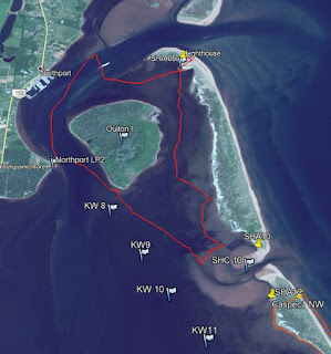
The best launch point to visit and explore the northern section of the Cascumpec Sandhills is the end of Northport Shore Road in western PEI. The Northport harbour is 1 km to the north, and Oulton Island is 400m directly across from the launch point. The 400m between the sandy launch point and Oulton Island is the channel used by Northport boat traffic to access Cascumpec Bay, Foxley River, and Mill River. So it can be reasonably busy with fishing and recreational boat traffic.


Cascumpec sandhills  (MYS15 9.6 km)


Google Earth track view

On this beautiful day, the tide wasn’t going to be all that high, but I hoped to have enough wind to sail along in Cascumpec Bay towards Black Point (south) while avoiding all those large sandflats.  Sometimes things work out - the sun is out, the tides are right, and the wind is in the sweet spot (i.e. not too light and not too strong). Today, the wind stayed weaker than expected for the north shore, so lots of rowing. 
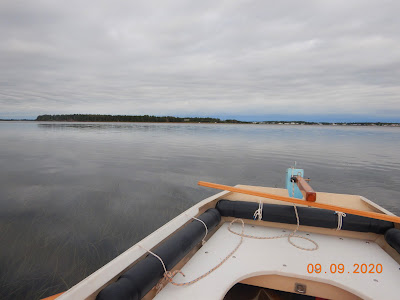
MYS15 under oars (Northport in the background)


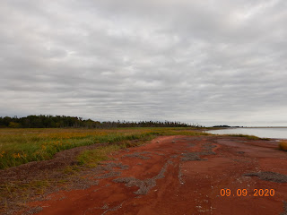
Oulton Island east shoreline


Oyster farming east of Oulton Island

So, there had to be a change of plans for the day. Under oars, I wasn’t getting too far. In calm weather, I can average 3 – 4 km/hr when rowing the MYS15 skiff. When sailing, the average speed can be up to 6 km/hr depending on many factors (wind, tack, etc.).  After leaving the launch point under oars, I headed for the south tip of Oulton Island and had a walk around while waiting for more wind.  But no wind came, so I decided to make for SHC10 (Sandhill Channel 10) instead of SHA15 (Sandhill Access 15). SHC10 was only about 1.5 km away, but still took a bit of time to get there – rowing in shallow water isn’t very fast.  I landed on the sandflat at SHC10 and dropped the anchor in shallow waters. The SHC10 sandflat is about 60 hectares, but the next one at Goose Harbour is enormous (150 hectares). 


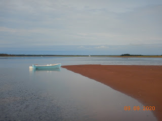
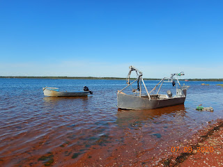
MYS15 at anchor (SHC10)


The SHC10 sand flat

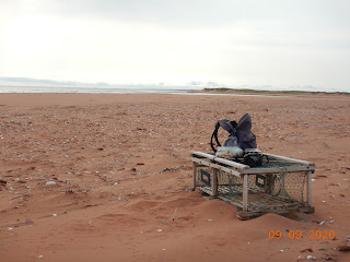
At SHC10, I did spend some time exploring the sand flats and photographing some nature sightings. It was also interesting to see that the locals are still putting out net traps for fish (eels, I think). From here, I concluded the wind would not cooperate for going any further (south) along the sandhill shore, so I decided to make it a day for exploring the north end of the Cascumpec Bay sandhills. 


Fish traps off SHC10 (usually eels)


A typical gulf-side beach view

Exploring the northern part of the Cascumpec Sandhills means going through the shallow water behind (east) Oulton Island. My destination was the lighthouse on the north tip of the sandhill (SHA05).  Once I got there, it was time for a short walk along the beach (gulf side) and lunch. There wasn’t anybody at the lighthouse, so I made use of their picnic table for lunch. The lighthouse is privately owned and sits on a 3 km section of the Cascumpec Sandhills that is still not protected. 


Cascumpec lighthouse (private)

Believe it or not, after lunch, a light breeze came up – making it worthwhile to set up the sail on my old skiff (MYS15).  I made it home under sail, but I didn’t take the best route. I made the mistake of staying too close to Oulton Island and got myself into pretty shallow waters. The MYS15 came close to getting stuck in grass and mud, but eventually, I made it into the Northport channel and deep water.  From here, it was a pleasant sail back to the launch point. 

Irrespective of the weather/wind, I always have a great time when out in one of my boats exploring PEI’s remote sandhills!  But, for this trip around Oulton Island and the northern Cascumpec Sandhill, it’s probably better done by kayak (next time).


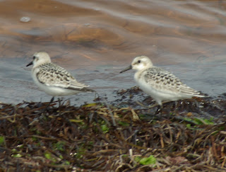
Sanderlings


Ruddy Turnstone


Northern Moon Snail


Red Fox footprint


Common Glasswort


Starry False Solomon's Seal

Semipalmated Plover

For more details on nature sightings, Click here.


Monday, 7 September 2020

Exploring Foxley Bay, Cascumpec


On a beautiful early September day, I decided to explore the Foxley Bay/River from Gordon’s wharf in Cascumpec. Gordon’s wharf is not a pier anymore, but it is still a very active boat launching spot for oystermen.  Gordon’s Point provides boating access north into Cascumpec Bay and south into the Foxley river system.  I have launched my MYS15 sailing skiff at Gordon’s wharf for trips into Cascumpec Bay in previous years. But today, for the first time, I was going to explore the Foxley Bay by kayak.


Foxley Bay area (13.2 km track)


GE map view

The Foxley Bay/River is a short river system with many channels to the south and east. The main channel is 12 km from the river mouth at Gordon’s Point to the Carleton bridge at highway 2. But, at the main river junction, the channel going upstream to the Carleton bridge is called the Trout River (not to be confused with the Trout River in Tyne Valley area or the Trout River near Stanley Bridge).


The first thing I noticed paddling up the Foxley Bay is the largest erratic I’ve ever seen in PEI.  It’s on the eastern shore near McNally’s Point.  Then, as I paddled further, I quickly realized that the Foxley River is one huge commercial oyster farm. There are oyster cages everywhere and also quite a few oyster processing platforms (floating buildings) on the river. I kept following the eastern shore and soon made a stop on a pleasant walking beach for a break.  I could hear the peat moss mining noises to the north of the beach (0.5 km away).  There’s an off-grid cottage on this beach (from Canadian Road). I’m not sure that this road is public to the shore, but there were a few trucks and boat trailers in the area.


From that beach, I crossed Foxley Bay to the shoreline just to the west of the MacDonald’s River.  That shore also turned out to be a lovely walking beach to explore and a good lunch place. But halfway through my bagel & peanut butter, an annoying noise started up just inside the shoreline – a tree harvesting machine was clearing out the forest on the west side at the mouth of the MacDonald River.


The 5 km paddle back to Gordon’s wharf was good with a short shore break and a few photos. I plan to explore the Foxley/Trout River network more over the next few years. Here are some possible trips (paddling or rowing):

-       Cascumpec bridge to the Carleton highway bridge (5.5+ km one way)

-       Cascumpec bridge to Mary River at highway 2 (4+ km one way)

-       Cascumpec bridge up the George River (3+ km one way)

-       Cascumpec bridge up the Portage River (4+ km one way)

-       Canadian Road bridge up the MacDonald’s River (4+ km one way)

-       Canadian Road bridge to Foxley River bridge (2.5+ km one way)

-       Gordon’s wharf up the Oyster River (3.5+ km one way)


Carolina Sea Lavender


Marsh Skullcap

For more Foxley Bay iNaturalist observations: Click here.


Sunday, 16 August 2020

Malpeque Sandhills via Bird Island


On a day where the weather was looking a bit unpredictable (rain), I decided to make a kayak trip to Bird Island and maybe to the back of Lennox Island. It turned out to be an excellent paddling outing with incredible scenery, nature observations, interesting weather contrast photos, and no rain!  My usual launch point for the northwest area of Malpeque Bay is Gillis Point.  You go to Port Hill, and then take the Low Point Road to the end.  From there, you follow a track around Gillis Point through a farmer’s field.


Gillis Point to Malpeque sandhill


GE map view (track 14.2 km)

I planned to paddle across to Bird Island and re-evaluate the weather before heading any further. After a walk on the western side of Bird Island and capturing a few nature observations, I decided to keep going towards the Malpeque sandhills (Billy Hook Island). At this point, there was no sign of any severe weather – although it was starting to look overcast towards the southwest. 

Beautiful day heading to Bird Island

The tide wasn’t the highest, but I did manage to get to the sandhill at SHA75 (about 3 km to the SE of Hardy’s channel). There’s a steep sandy path over the sandhill at SHA75 – a bit of a challenge to climb over. I had my lunch at the top with a sea view that would be hard to beat in PEI. I did start to get a bit worried, the overcast sky was approaching from the west, and there was a good chance that I was paddling back in the rain.


Sandhill, looking east


Sandhill, looking west

Merganser kayak on Malpeque sandhill

After lunch, it was more nature observation photography on the sandhill shoreline.  By chance, the on-line HOBO sandhill weather station was just west of SHA75. The return paddle (6 km) was a direct route to Gillis Point while expecting to get rain (or worse) at any time. It was my lucky day! Even though the sky got dark and threatening, the rain and wind never materialize, and I got back without any weather issues.


One hour later approaching Gillis Point

I hope to make this trip again next year over a full day (minus the dark skies)!

For all iNaturalist observations recorded on this trip, click here.


Monday, 10 August 2020

The Conway Narrows to Malpeque Bay Passage


I have paddled and sailed most of the waters along the PEI sandhills between Alberton and Cabot Park (40 km). But, this summer, I realized that I’ve never gone through from the Conway Narrows to Malpeque Bay via the Hardy channel. If it were practical to sail from Seaweed Road to Malpeque Bay, it would give me an alternate way to explore the Malpeque sandhill (Bill Hook or Fish Island), Lennox Island, Bird Island, and Hog Island.


Hardy channel bypass route options

There are two options to make the passage through the huge Hardy sandflat. There’s the deep marked channel used by the Milligan Wharf’s fishermen. This deep route follows the sandhill shore and eventually goes out into the gulf.  But, there’s also a deep narrow channel that leads into Malpeque Bay (see blue line on GE map). This sandhill route would be difficult to follow with a sailboat, so it’s better as a paddling route.

Kayak track, 12.5km

The other route is to follow the mainland shore all the way through. This is the area I set to explore this summer, so I made two trips to the area.  The first outing was by kayak from Milligan’s Wharf to assess the water’s width and depth in this area for sailing. It could be tight, but I think that my 16ft OSC would be able to sail through assuming high tide and some favourable winds!

OSC track, 12.9km

On August 10th, I launched the OSC at Seaweed Road (Conway Narrows) and headed SE hoping to get to SHA70 on Malpeque sandhill (i.e. Bill Hook Island). Initially, the wind was great as I progressed towards Milligan’s Wharf, but it didn’t last.  I went ashore after Milligan’s Wharf for a walk and to pick-up a bowl-shaped rock that I’d seen on my kayak trip a few weeks earlier. After thinking that the winds were done for a while, I decided to start heading back under sail and paddle. An hour later, as I was approaching Seaweed Road, a nice breeze came. So I headed towards the sandhill (SHA55) for a short walk and lunch on the beach (gulf side). Afterwards, it was a nice sail straight across Conway Narrows to Seaweed Road (1.6km).

Definitely looking forward to next summer to try that sail plan again!


Milligan's Wharf


Bowl-shaped stone


References: Some history of the Hardy channel area and lighthouse.
1) Lighthouse Friends, click Here.
2) PEI Lighthouse Society, click HERE.


Pics below from my July 27th kayak trip to the Hardy channels.


What could be better for a sail!