|
|
The Foxley Bay/River
is a short river system with many channels to the south and east. The main
channel is 12 km from the river mouth at Gordon’s Point to the Carleton bridge
at highway 2. But, at the main river junction, the channel going upstream to
the Carleton bridge is called the Trout River (not to be confused with the
Trout River in Tyne Valley area or the Trout River near Stanley Bridge).
|
|
|
The first thing I
noticed paddling up the Foxley Bay is the largest erratic I’ve ever seen in
PEI. It’s on the eastern shore near
McNally’s Point. Then, as I paddled
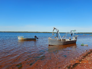
further, I quickly realized that the Foxley River is one huge commercial oyster
farm. There are oyster cages everywhere and also quite a few oyster processing
platforms (floating buildings) on the river. I kept following the eastern shore
and soon made a stop on a pleasant walking beach for a break. I could hear the peat moss mining noises to
the north of the beach (0.5 km away). There’s
an off-grid cottage on this beach (from Canadian Road). I’m not sure that this
road is public to the shore, but there were a few trucks and boat trailers in
the area.
|
|
|
|
|
|
From that beach, I
crossed Foxley Bay to the shoreline just to the west of the MacDonald’s River. That shore also turned out to be a lovely
walking beach to explore and a good lunch place. But halfway through my bagel
& peanut butter, an annoying noise started up just inside the shoreline – a
tree harvesting machine was clearing out the forest on the west side at the mouth
of the MacDonald River.
|
|
|
The 5 km paddle back
to Gordon’s wharf was good with a short shore break and a few photos. I plan to
explore the Foxley/Trout River network more over the next few years. Here are
some possible trips (paddling or rowing):
-
Cascumpec
bridge to the Carleton highway bridge (5.5+ km one way)
-
Cascumpec
bridge to Mary River at highway 2 (4+ km one way)
-
Cascumpec
bridge up the George River (3+ km one way)
-
Cascumpec
bridge up the Portage River (4+ km one way)
-
Canadian
Road bridge up the MacDonald’s River (4+ km one way)
-
Canadian
Road bridge to Foxley River bridge (2.5+ km one way)
- Gordon’s wharf up the Oyster River (3.5+ km one way)
|
|
|
||||
|
|
For more Foxley Bay iNaturalist observations: Click here.


No comments:
Post a Comment
Note: only a member of this blog may post a comment.