Tuesday, 20 July 2021

Portage River - Foxley/Trout River, PEI


I started exploring the Foxley/Trout River system in 2020 and continued this year with two more trips.  The first trip was to the Portage River from Route 12 Goff’s Bridge launch site. The launch site is at the NW corner of Goff’s Bridge and is heavily used by the aquaculture oyster industry. With all the aquaculture farming activities in the area, the Foxley/Trout River system is best for paddling and limited sailing - the sail-&-oar MYS15 skiff is the best choice.

Portage River and track (July 20, 2021)

On July 20, I planned to sail or row across the Trout River and then head up the Portage River to check out the INT property bordering the Portage River to the east. My first stop was on the west bank of the Portage River to explore, and then I crossed over to the east shore and went for a walk in the INT property. The winds were pretty light, but I did manage to sail to the end of the Portage River.

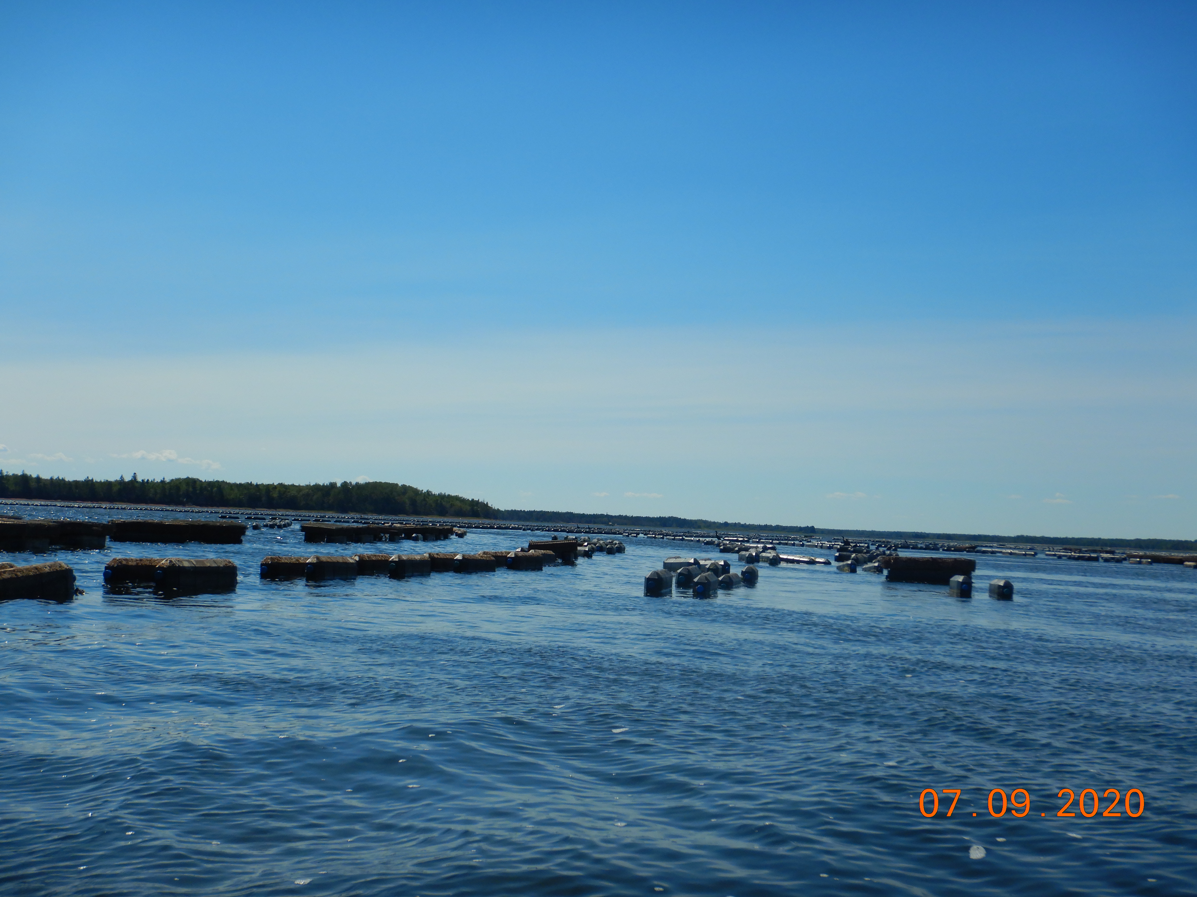
Oyster aquaculture operation

MYS15 in Portage River


The INT property includes a large wetland bordering the Portage River with all kinds of vegetation. One shrub I observed there is Swamp Birch, apparently relatively rare in PEI (S2). There were also butterflies and dragonflies in the area (e.g. Common Wood-Nymph, Common Whitetail).  For other nature obnservations (iNaturalist), click HERE.

After walking to Tory Road through the forest, I returned to the boat and started the trip back. Unfortunately, the wind had given up, so it was the oars all the way back. But before leaving the Portage River, I did make a lunch stop on a walkable beach on the east side of the river.


Swamp Birch (rare in PEI)


Shore access (east bank, Portaaage R)

The Portage River needs another trip by kayak to allow for more exploring options and a longer walk in the INT property. Even though it’s more developed, a kayaking trip to the west of Goff’s Bridge would be nice for exploring the Trout, George, and Mary Rivers.

Wetland (bottom of Portage River, INT property)


Monday, 19 July 2021

Goose Creek - Grand River, PEI


The Grand River source is above the town of Wellington and flows out into Malpeque Bay. It’s a 15km waterway from Wellington to Belmont Park (Malpeque Bay). The river is about 3km wide at its mouth in Malpeque Bay and still 0.5km wide upriver at the bridge. At 1km above the Grand River bridge, the river narrows considerably – it’s only 50m wide at the highway 2 bridge and about 10m in Wellington. The Grand River is wide and deep enough for sailing below the Grand River bridge (10km) – especially at high tide.  Going upriver from the Grand River bridge, it’s best to be paddling or rowing. 

Grand River (above main bridge)

July 19 didn’t look like a great sailing day, so I decided to go and explore a part of the Grand River by kayak (WD12). The main launch point for the Grand River is in the SE corner of the Grand R. bridge. The oyster fishers/farmers have a crude ramp there and a good parking area. In the past, I have launched the MYS15 skiff at the Grand R. bridge.  

Common sight at the Grand River bridge launch

After launching the WD12, I headed upriver following the east shore and then into Goose Creek. The Goose Creek area is a large wetland, and I did go ashore to explore. I didn’t see too much interesting on my walk, but afterwards, I noticed something very particular on the eastern edge of the wetland. There’s a north-south line of 10 donut shapes visible on Google Earth!  They are all about 30m in diameter with a center of 10m. It’s something interesting to figure out! See Rosemary’s note below.


Marsh at Goose Creek/River

After some more paddling upriver, I went ashore on the west bank (across from Goose Creek) for a break and a short walk. Onshore, I was lucky to observe and photograph a globally rare butterfly (Salt Marsh Copper). I slightly detoured to investigate the small inlet leading to  Leckys Pond and the Smelt River on the paddle back towards the bridge.  A short dam blocks the access to Leckys Pond and the Smelt River - getting in there will require some portaging!


Salt Marsh Copper butterfly (rare)


Belted Kingfisher

Another place that would be interesting/fun to explore is the old Grand River airport. It’s still visible on Google Earth and could be accessed via the Little Trout River (something for next year). There’s also a PEI demo woodlot and trails (Camp Tabawaby) adjacent to the airport and bordering the Grand River.  Also, I need to try a paddle downriver and into Nebraska Creek (another wetland system to explore).


Grand River, west bank


Inlet to Leckys Pond (blocked)


-----------------------------------------------------------------------------------------------------------------------

(from Rosemary Curley, Nature PEI)

Hi Denis,
It was not done by Martians. Those circles were made by excavating the marsh to create some water areas on the upper marsh. I believe the actual work was done by Ducks Unlimited Canada, but it was through the Eastern Habitat Joint Venture, which was a cooperative program of 5 eastern provinces, the feds and US Fed, and DUC. Probably early 1990s. I was program Manager for EJHV.

I don’t know that the donuts made at Grand River were very successful, for one thing, the follow-up was probably underwhelming.

Cheers,
Rosemary

Man-made water reservoir donuts (Goose Creek, 1990s)

===================================================================

2024July23 Update

My July 23rd track, WD12, 7.4km

My nature observations (posted to iNaturalist) for July 23rd are HERE.
Similar to the 2021 trip, the highlight was a Salt Marsh Copper butterfly (globally rare).

This was a fun paddle to the DUC doughnut habitats. With high water, I was able to paddle pretty close to the northern most doughnut pond over the submerged marsh grass. After checking out "P1, N DUC", I tried to reach "P2, DUC" on foot but had to turn back due to Poison Ivy. Then, I paddled back to the Goose River, and made my way to check out the most southerly pond (P10, DUC). No ducks were observed at either ponds, but an interesting salt-marsh area with lots of nature.


Bald Eagles


Salt Marsh Copper butterfly


Goose River salt-marsh


DUC doughnut pond


Friday, 11 September 2020

Northern Cascumpec Sandhill - Northport, PEI


The best launch point to visit and explore the northern section of the Cascumpec Sandhills is the end of Northport Shore Road in western PEI. The Northport harbour is 1 km to the north, and Oulton Island is 400m directly across from the launch point. The 400m between the sandy launch point and Oulton Island is the channel used by Northport boat traffic to access Cascumpec Bay, Foxley River, and Mill River. So it can be reasonably busy with fishing and recreational boat traffic.


Cascumpec sandhills  (MYS15 9.6 km)


Google Earth track view

On this beautiful day, the tide wasn’t going to be all that high, but I hoped to have enough wind to sail along in Cascumpec Bay towards Black Point (south) while avoiding all those large sandflats.  Sometimes things work out - the sun is out, the tides are right, and the wind is in the sweet spot (i.e. not too light and not too strong). Today, the wind stayed weaker than expected for the north shore, so lots of rowing. 

MYS15 under oars (Northport in the background)


Oulton Island east shoreline


Oyster farming east of Oulton Island

So, there had to be a change of plans for the day. Under oars, I wasn’t getting too far. In calm weather, I can average 3 – 4 km/hr when rowing the MYS15 skiff. When sailing, the average speed can be up to 6 km/hr depending on many factors (wind, tack, etc.).  After leaving the launch point under oars, I headed for the south tip of Oulton Island and had a walk around while waiting for more wind.  But no wind came, so I decided to make for SHC10 (Sandhill Channel 10) instead of SHA15 (Sandhill Access 15). SHC10 was only about 1.5 km away, but still took a bit of time to get there – rowing in shallow water isn’t very fast.  I landed on the sandflat at SHC10 and dropped the anchor in shallow waters. The SHC10 sandflat is about 60 hectares, but the next one at Goose Harbour is enormous (150 hectares). 


MYS15 at anchor (SHC10)


The SHC10 sand flat

At SHC10, I did spend some time exploring the sand flats and photographing some nature sightings. It was also interesting to see that the locals are still putting out net traps for fish (eels, I think). From here, I concluded the wind would not cooperate for going any further (south) along the sandhill shore, so I decided to make it a day for exploring the north end of the Cascumpec Bay sandhills. 


Fish traps off SHC10 (usually eels)


A typical gulf-side beach view

Exploring the northern part of the Cascumpec Sandhills means going through the shallow water behind (east) Oulton Island. My destination was the lighthouse on the north tip of the sandhill (SHA05).  Once I got there, it was time for a short walk along the beach (gulf side) and lunch. There wasn’t anybody at the lighthouse, so I made use of their picnic table for lunch. The lighthouse is privately owned and sits on a 3 km section of the Cascumpec Sandhills that is still not protected. 


Cascumpec lighthouse (private)

Believe it or not, after lunch, a light breeze came up – making it worthwhile to set up the sail on my old skiff (MYS15).  I made it home under sail, but I didn’t take the best route. I made the mistake of staying too close to Oulton Island and got myself into pretty shallow waters. The MYS15 came close to getting stuck in grass and mud, but eventually, I made it into the Northport channel and deep water.  From here, it was a pleasant sail back to the launch point. 

Irrespective of the weather/wind, I always have a great time when out in one of my boats exploring PEI’s remote sandhills!  But, for this trip around Oulton Island and the northern Cascumpec Sandhill, it’s probably better done by kayak (next time).


Sanderlings


Ruddy Turnstone


Northern Moon Snail


Red Fox footprint


Common Glasswort


Starry False Solomon's Seal

Semipalmated Plover

For more details on nature sightings, Click here.


Monday, 7 September 2020

Exploring Foxley Bay, Cascumpec


On a beautiful early September day, I decided to explore the Foxley Bay/River from Gordon’s wharf in Cascumpec. Gordon’s wharf is not a pier anymore, but it is still a very active boat launching spot for oystermen.  Gordon’s Point provides boating access north into Cascumpec Bay and south into the Foxley river system.  I have launched my MYS15 sailing skiff at Gordon’s wharf for trips into Cascumpec Bay in previous years. But today, for the first time, I was going to explore the Foxley Bay by kayak.


Foxley Bay area (13.2 km track)


GE map view

The Foxley Bay/River is a short river system with many channels to the south and east. The main channel is 12 km from the river mouth at Gordon’s Point to the Carleton bridge at highway 2. But, at the main river junction, the channel going upstream to the Carleton bridge is called the Trout River (not to be confused with the Trout River in Tyne Valley area or the Trout River near Stanley Bridge).


The first thing I noticed paddling up the Foxley Bay is the largest erratic I’ve ever seen in PEI.  It’s on the eastern shore near McNally’s Point.  Then, as I paddled further, I quickly realized that the Foxley River is one huge commercial oyster farm. There are oyster cages everywhere and also quite a few oyster processing platforms (floating buildings) on the river. I kept following the eastern shore and soon made a stop on a pleasant walking beach for a break.  I could hear the peat moss mining noises to the north of the beach (0.5 km away).  There’s an off-grid cottage on this beach (from Canadian Road). I’m not sure that this road is public to the shore, but there were a few trucks and boat trailers in the area.


From that beach, I crossed Foxley Bay to the shoreline just to the west of the MacDonald’s River.  That shore also turned out to be a lovely walking beach to explore and a good lunch place. But halfway through my bagel & peanut butter, an annoying noise started up just inside the shoreline – a tree harvesting machine was clearing out the forest on the west side at the mouth of the MacDonald River.


The 5 km paddle back to Gordon’s wharf was good with a short shore break and a few photos. I plan to explore the Foxley/Trout River network more over the next few years. Here are some possible trips (paddling or rowing):

-       Cascumpec bridge to the Carleton highway bridge (5.5+ km one way)

-       Cascumpec bridge to Mary River at highway 2 (4+ km one way)

-       Cascumpec bridge up the George River (3+ km one way)

-       Cascumpec bridge up the Portage River (4+ km one way)

-       Canadian Road bridge up the MacDonald’s River (4+ km one way)

-       Canadian Road bridge to Foxley River bridge (2.5+ km one way)

-       Gordon’s wharf up the Oyster River (3.5+ km one way)


Carolina Sea Lavender


Marsh Skullcap

For more Foxley Bay iNaturalist observations: Click here.